


In the Peruvian Amazon, tropical diseases pose a growing risk – and scientists are turning to advanced technology, including drones and artificial intelligence, to try to stop outbreaks before they start.
Iquitos, Peru it cannot be reached by road because of the dense jungles and waters surrounding the city. Only planes or boats can reach the metropolis of around half a million people. All that water and vegetation also means an unwelcome guest: mosquitoes.
Mosquitoes can transmit tropical diseases such as malaria and dengue fever. In 2000, the World Health Organization recorded just half a million global cases of dengue fever, but nearly two decades later, the organization reported 5.2 million cases.
Gabriel Carrasco, who leads the research project at the Universidad Peruana Cayetano Heredia in Lima, Peru, said the rise in dengue shows how climate change affects developing tropical nations most – even though those countries have a much smaller carbon footprint than than industrialized nations.
“Events are more frequent. For example, El Nino it is more frequent now than it was a few years ago. (There are) flooding events (and) extreme heat events in areas where they were previously also unreported,” Carrasco said.
The consequences of heat and strong storms can result in ideal breeding grounds for mosquitoes.
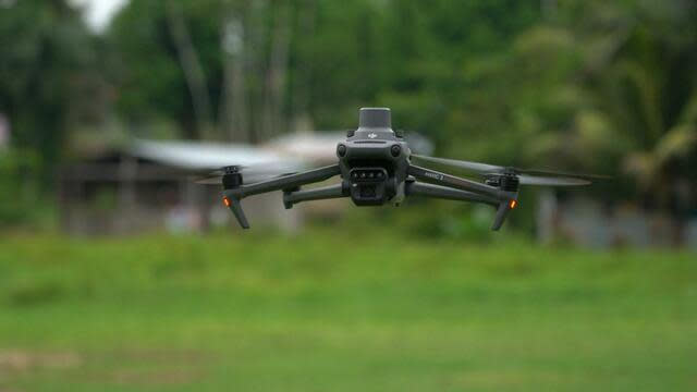
Researchers like Carrasco and Bryan Fernandez use drones to take high-resolution photos in and around the Amazon, looking for bodies of water that could be breeding grounds for mosquitoes. Drones take photos every three seconds and these images are turned into 3D images that track water and deforestation. The team also uses weather sensors to track conditions and small recording devices to monitor changes in the types of areas passing through the area.
That information is then fed into an AI model that “can predict where an outbreak might occur,” Fernandez said.
“The idea now is how can we make these models much more accurate and detailed at the village level,” explained Carrasco.
The hope is to spread the technology to areas around the world with limited medicines, vaccines and doctors, Carrasco said. Knowing where spread is likely can help areas distribute resources strategically. However, that model is still potentially years away, so Carrasco and other researchers will continue to look for answers and do what they can to help the most vulnerable.
“What we’re trying to do is help people in really poor areas survive,” Carrasco said.
Supreme Court invalidates bump stock ban implemented after Las Vegas mass shooting
Princess Kate makes first official appearance in months
Breaking Down the Supreme Court Ruling on the Mifepristone Abortion Pill


