


Severe and dangerous storms will hit the eastern half of the U.S. this Memorial Day weekend, affecting several major cities from Saturday through Monday.
The storms will begin on Saturday, with 18 million people from Texas to Iowa under high threat of severe storms, the strongest of which will hit Oklahoma, Kansas and Missouri, including Oklahoma City and Tulsa, Oklahoma; Joplin, Missouri; and Wichita, Kansas.
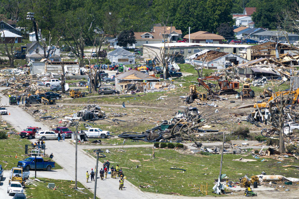
Storms over Oklahoma and Texas are expected to move east toward Missouri and Iowa overnight. Some long-lived supercells are also expected. These storms are capable of producing intense tornadoes, giant hail, and destructive wind gusts.
Clusters of these supercells will merge, creating larger storm systems in northern Oklahoma and central and eastern Kansas overnight, the National Weather Service said. said on Xadding that “a few isolated or widely scattered instances of flash flooding” will be possible until midnight.
The storms will continue to move east on Sunday, moving into the Midwest and Ohio Valley. They are expected to affect 42 million people in cities including Chicago, Indianapolis, Nashville, St. Louis and Cincinnati.
Damaging wind gusts are most expected across the Midwest, but tornadoes and large hail are also possible.
The storms will end on the East Coast on Monday, with a slight risk of severe weather in the mid-Atlantic. In this region, including Baltimore; Washington DC; and Charlotte and Raleigh, North Carolina, 27 million are at risk of strong to severe storms.
The main danger to watch out for is strong wind, but a thunderstorm or two could produce large hail or a tornado.
With this active storm pattern comes the risk of flash flooding, especially throughout the Mississippi Valley. In total, 3 million are under flood warnings, including cities like Memphis, Tennessee; and Tupelo, Mississippi.
Precipitation totals generally range from 1 to 2.5 inches during the weekend, with localized amounts greater than 3 inches possible where training storms develop.
Southern heat
While the South will not experience storms over Memorial Day weekend, it will experience extreme heat.
Summer-like temperatures will affect the southern Plains and Gulf Coast as maximum temperatures rise to 10-20 degrees above average.
Heat warnings are in effect for 7 million people in South Texas on Saturday, including Austin, San Antonio, Corpus Christi and Brownsville, as temperatures will rise to 100-115 degrees.

Nearly two dozen record highs will be threatened Saturday afternoon when temperatures reach 90-100 in Brownsville and Houston, Texas; Key West, Florida; and New Orleans.
Both Brownsville and Harlingen, Texas, set new daily records on Saturday, with Brownsville reaching 99 degrees and Harlingen at 100 degrees, according to the NWS, both 2 degrees above their previous records.
On Sunday, more heat will cover the South, with more than 20 records threatened in Corpus Christi; Miami and Orlando, Florida; Baton Rouge, Louisiana; Dallas, Houston and San Antonio.
Extreme fire conditions
Four million are under alert for critical fire weather conditions in the High and Southern Plains from Colorado to Texas, including Albuquerque and Santa Fe, New Mexico; and El Paso, Texas.
Newly formed fires are at risk of spreading quickly due to the dangerous combination of dry vegetation, 30-45 mph winds and low relative humidity.
This article was originally published in NBCNews. with


