A Severe Thunderstorm Warning was issued to Preble until 10pm
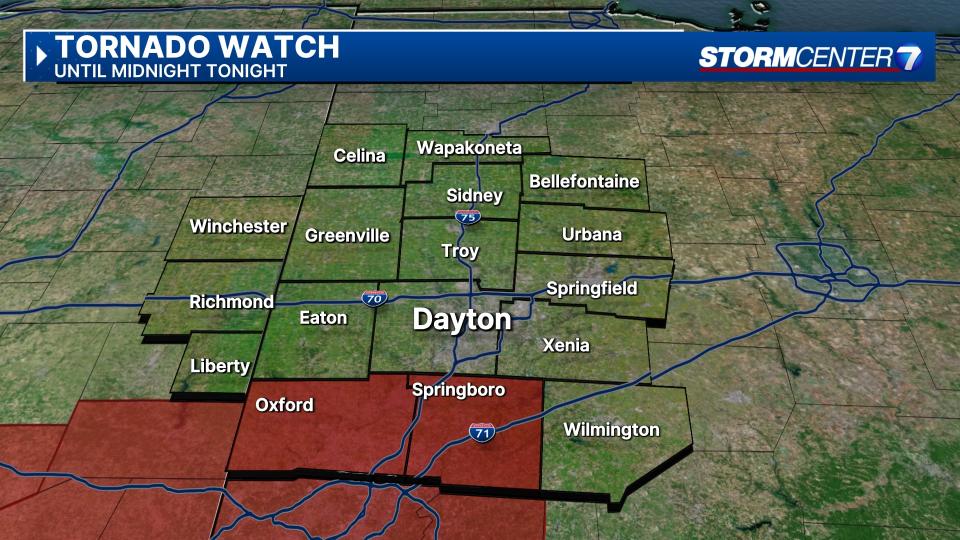
A Tornado Watch was issued to Butler, Warren, Preble and Union (Indiana) counties until midnight.
>> FOLLOW THE LATEST CONDITIONS: Live Doppler 7 Radar
The remnants of Beryl approach on Tuesday bringing more clouds and increasing rain chances.
The heaviest rainfall is expected to occur around midnight Tuesday through Wednesday, according to Storm Center 7 meteorologist Ryan Marando.
As we are east of the center of circulation, some storms may trigger one or two isolated tornadoes.
We expect between a half inch to an inch and a half of rain, so there are no major concerns about flooding.
Highs reach the mid-80s.
Winds during the day should not be excessively strong.
Gusts of up to 20 mph are possible, and these gusts have a chance to increase to around 25 mph overnight.